Palaui Destinations
About Palaui
Cape Engano
Baratubot Falls
View Deck
Also Famous for Survivor
List of Other Things to Do and See
About Palaui
The Palaui Island Protected Landscape and Seascape is an island that is a protected area and national park in the municipality of Santa Ana in Cagayan, Philippines. It is located off the northeastern extremity of Luzon Island.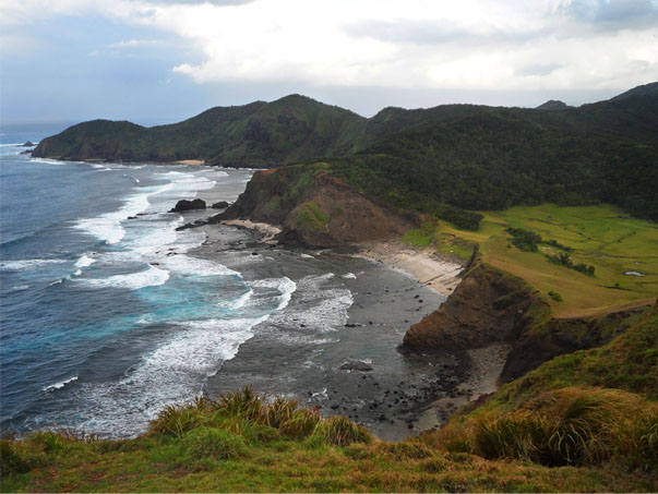
Palaui Island lies off the northwestern part of a large promontory in San Vicente, in the municipality of Santa Ana, Cagayan province. It is 10 kilometres (6.2 mi) at its longest and about 5 kilometres (3.1 mi) at its widest and moderately high. The western shore of the island appears bold, but on the eastern side, a reef projects from its side for 2.4 kilometres (1.5 mi), the edge of it being 0.8 kilometres (0.50 mi) from and extending around the small islet of Escucha, east of Palaui. The Dos Hermanos rocky islets lie off Cape Engaño, in the northern point of Palaui, and there are some rocks off the northeast point of the island, about 1.6 kilometres (0.99 mi) eastward of the cape. Gran Laja island, a low rock islet surrounded by breakers, is one of the rocks located northeast off Palaui.
At the southwest end of Palaui Island is Puerto Point, a high, wooded bluff. East of the point and south of Palaui is Rona Island, a low, wooded island with a white base of sand and rocks. Escucha Island is a high and wooded islet east of Palaui, and beyond Rona Island when seen from southwestward through the channel between Palaui Island and the mainland, where a few more islets are located.